[title size=”2″]Past Projects[/title]
[accordian]
[toggle title=”FDOT District 3 District-Wide Miscellaneous Roadway Digital Mapping”]HSA provided photogrammetric and transportation statistics services on approximately 2400 miles of On-System Roadways, including ground control, aero-triangulation, ortho-mosaics and extraction of Roadway Characteristics Inventory (RCI) data. (1999 – 2006)
[/toggle]
[accordian]
[toggle title=”FDOT District 3 Photogrammetric Extraction Pilot Projects”]HSA worked with two different engineering firms to complete the district’s photogrammetry pilot projects. For these projects, the survey data was extracted using digital softcopy technology including development of digital terrain models for portions of the project area for using 1200’ AGL flights imagery, scanned at 14 microns. HSA developed a customized desktop software application, SurveyCreator, to extract topographic survey data using Electronic Field Book (EFB) naming conventions and file output formats. Accuracies of 1/10 of one foot were independently verified. (2003)
- Hatch Mott MacDonald (formerly Carlan Killam Consulting Group, Inc) (for FDOT District 3) Milling, Resurfacing & Minor Design of SR 85 from SR 123 to North of Brock Avenue, totaling 14 miles in length in Okaloosa County. (2003)
- Baskerville-Donovan, Inc. – (for FDOT District 3) Milling, Resurfacing & Minor Design of SR 393 from US 98 (SR 30) to Beal Parkway in Okaloosa County – Urban Section approximately 2 miles in length. (2003)
[/toggle]
[accordian]
[toggle title=”HDR (for City of Panama City Beach)”]Photogrammetric Project in Bay County. This project was flown at 2500’ AGL, and scanned at 14 microns. It generated over 400 stereo models at 3.4” resolution. HSA provided the ground control, targeting and GPS survey control to support an 8 cm horizontal RMSE accuracy. 1’ contours were developed for Stormwater Master Plan Development. The rectified imagery was used as a baseline geo-spatial layer for development of a “Virtual City Hall” web-based IT. A seamless color ortho-mosaic was also generated for use in the City’s web-based application. (2007)
[/toggle]
[accordian]
[toggle title=”Wilbur Smith & Assoc. – (for FAMU, Leon County)”]Campus-Wide Electrical Upgrades/Technology Infrastructure-PHASE 3. Pairs of GPS control points were established as primary control with the horizontal datum tied to Florida State Plane North, NAD 83 (99) and the vertical datum tied to NAVD 88. Existing topography and planimetric features were located in 3D and provided to the Design Engineer. HSA also provided 1’ contour maps and seamless color ortho-mosaic. (2009)
[/toggle]
[/accordian]

[separator top=”40″]
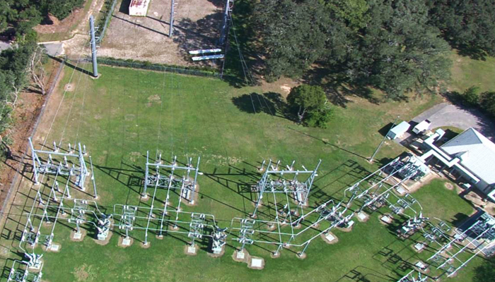
Aerial Cartographics of America – (for City of Tallahassee Utility Department) Leon Lidar Power Transmission Line Mapping Project in Leon, Gadsden and Wakulla Counties. HSA served as the Prime Consultant for this 175 mile Power Transmission line project. Work included setting targets on ground for horizontal and vertical control, the extraction of planimetric data from aerial photography and the ground check QA/QC of extracted data for accuracy and thoroughness. HSA also coordinated the staged final delivery of all sub consultant products to the City of Tallahassee Utility Department. (2012)
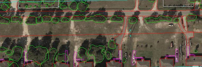
Planametric Extraction taken from the aerial photography along the Power Line Corridor
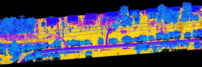
Point Cloud Data taken from the helicopter along the Power Line Corridor
[separator top=”40″]
[accordian]
[toggle title=”Simwright, Inc. (for Flagler County Airport (XFL) Flagler County)”]HSA collected ground control survey data on airport property, created stereo pairs (R3D data) at a 3” resolution and 8cm horizontal, 12 cm vertical accuracy, and generated a block-adjusted aero-triangulation solution for use by the prime consultant in generating planimetrics for airport obstruction clearance analysis.
[/toggle]
[accordian]
[toggle title=”Simwright, Inc. (for Tampa International Airport (TIA) Hillsborough County)”]Set aerial targets and collected high order GPS horizontal and vertical positions within a 6 mile by 8 mile grid for the acquisition and ortho-rectification of low level imagery. (2004)
[/toggle]
[accordian]
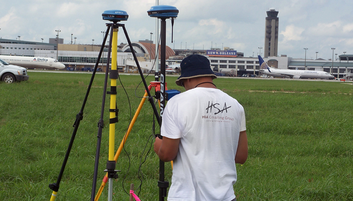
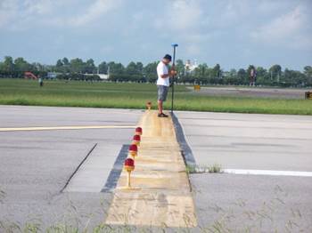
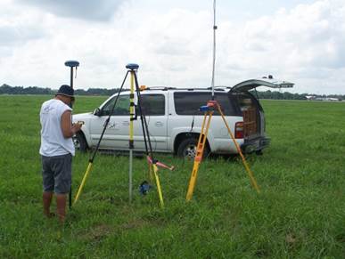
[toggle title=”SimWright Inc. (for Federal Aviation Administration) New Orleans International Airport (MSY)”]Obstruction Survey and Airport Airspace Analysis to support approach procedure development. Set ground targets and acquired GPS positions for aerial photography. (2010)
[/toggle]
[/accordian]


[separator top=”40″]
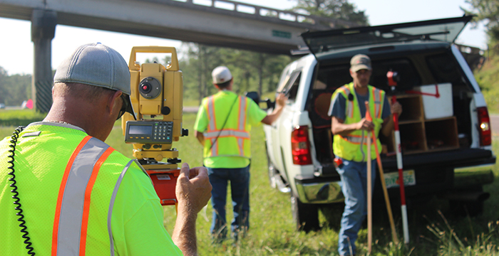
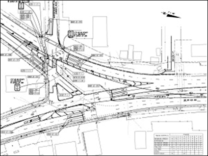
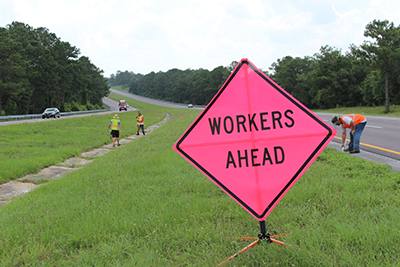
HSA’s field crews established Vertical and Horizontal Control, collected survey data for full Topographic survey, including: Alignment, Utilities, Drainage, Cross Sections, Wetlands and DTM’s using GPS and digital surveying equipment and data collectors. Data collection and all work performed complied with County/City procedures, requirements and Surveying and Mapping Standards and Florida Statues. HSA created and submitted point data and AutoCAD drawings of the project, compliant with City/County requirements, to the Prime Engineering firm for use in final project design.
[toggle title=”Power Engineering, Inc. (for City of Tallahassee Utility Department)”]Tallahassee 115kV Underground Transmission Line Project, Leon County. The project was defined as three separate underground transmission line segments per the City of Tallahassee preliminary routing. (2006)
[/toggle]
[accordian]
[toggle title=”LPA Group (for Okaloosa County Public Works) SR 293″]White Point Road) Sidewalk Design. (2008)
[/toggle]
[accordian]
[toggle title=”England, Thims & Miller Inc. for Jacksonville Transportation Authority (JTA)”]
- Alta Drive Resurfacing, Restoration and Rehabilitation Project in Duval County. (2009)
- Bus Rapid Transit, Jacksonville, Duval County. (2011)
- Bus Rapid Transit North Corridor in Duval County. (2012)
[/toggle]
[accordian]
[toggle title=”ATKINS/Formerly PBS&J (for Leon County Public Works)”]
- Killearn Lakes Stormwater Permitting, Tallahassee, Leon County. (2010)
- Miccosukee Community Park, Leon County. (2010)
- Timberlake Stormwater Design Project in Leon County. (2010)
- Fairbanks Ferry Emergency Access Road Design Project in Leon County. (2010)
- Selena Road from Woodville Hwy to Kelli Loop in Leon County. (2010)
- Killearn Lakes Stormwater Permitting – Phase 1 of the recorded subdivisions of Killearn Lakes 1, 2 & 3. (2011)
- Killearn Lakes Stormwater Permitting – Phase 2. (2011)
- Killearn Lakes Phase 2 Stormwater Enhancement Project in Leon County. Jurisdictional wetland location and mapping for approximately 2 miles in Killearn Lakes Subdivisions (2012)
- South Martin Luther King Blvd. Enhancement Project in Leon County. (2012)
[/toggle]
[accordian]
[toggle title=”ATKINS/Formerly PBS&J (for City of Tallahassee) Utility Easements Project”](California Street & Campus Avenue) Leon County. (2012)
[/toggle]
[accordian]
[toggle title=”RS&H (for Leon County Public Works)”]Bannerman Road Corridor Study in Leon County. (2010)
[/toggle]
[/accordian]
[toggle title=”Greenhorne & Omara (for BluePrint 2000) Leon County”]
- Design/Build project on Capital Circle Southeast from Crawfordville Hwy to Woodville Hwy, Leon County. (2010)
- Design/Build project on (SR 263) Capital Circle Southeast from Crawfordville Hwy to Woodville Hwy, Leon County. Utility As-Builts (2012)
[/toggle]
[accordian]
[toggle title=”McNeil/Carroll Engineering Inc. (for City of Panama City)”]SR 79 from south of the Intercoastal Waterway to north of the CR 388 intersection in Bay County. (2011)
[/toggle]
[accordian]
[toggle title=”Inovia Consulting Group (for the City of Tallahassee)”]
- Karen Lane Drainage Improvements in Leon County. (2010)
- Sanitary sewer service line locations on Baldwin Dr. in Leon County. (2012)
[/toggle]
[accordian]
[toggle title=”Inovia Consulting Group (for City of Carrabelle) SR 30/US 98″]Sidewalk Design/Build from CR 67 to Kenneth B. Copeland Ave. in Carrabelle, Franklin County. (2011)
[/toggle]
[accordian]
[toggle title=”Inovia Consulting Group (for Leon County Public Works) Copper Creek Drive”]Topographic survey for Stormwater Design Project in Leon County. (2011)
[/toggle]
[/accordian]


[separator top=”40″]

HSA’s field crews collected survey data for Topography, Alignment, Utilities, Drainage, Cross Sections, Wetlands and Minor DTM areas using EFB data collection and all work performed complied with FDOT procedures, requirements and Surveying and Mapping Standards. HSA calculated and staked the FDOT approved Centerline Alignment, produced Project Control Maps and submitted CAD compliant MicroStation Design files, exported from the CAiCE database, for submittal to the Prime Engineering firm for final project design.
[accordian]
[toggle title=”LPA Group”]
- Milling, Resurfacing & Sidewalk design of SR 95/US 29 in Escambia County. Full survey services performed. (2007)
- Holmes County Bridge Replacement, Corinth Road over Otter Creek & Bonifay Chipley Road over Unnamed Branch. Full survey services performed. Right-of-Way Map/Maintenance Maps were provided by HSA and were included on the Control Survey Maps. (2008)
[/toggle]
[accordian]
[toggle title=”Fisher & Arnold Inc.”]
- Milling & Resurfacing of SR10 (US 90A) from east of Perdido River Bridge to Pine Cone Dr. in Escambia County. Full survey services performed. (2008)
- Milling & Resurfacing of SR 75 (US 231) from Mill Road to north of Brock Road, Jackson County. Partial survey services performed. (2011)
- Milling & Resurfacing of SR 75 (US 231) from Mill Road to north of Brock Road, Jackson County. Partial survey services performed. (2011)
[/toggle]
[accordian]
[toggle title=”Metric Engineering “]Milling & Resurfacing of SR 20 (US 19/27) from west of SR 57 (US 19) to west of J.C. Lee Road in Jefferson County. Partial survey services performed (2010)
[/toggle]
[accordian]
[toggle title=”GPI Southeast Inc. “]Design Survey from SR 295/SR 727 to SR 289 (9th Ave.) in Escambia County. Full survey services performed. (2011)
[/toggle]
[accordian]
[toggle title=”David H. Melvin Inc. Consulting Engineers”]SR 22 from the Bay County Line to Wettappo Creek, Bay County. Partial survey services performed (2011)
[/toggle]
[accordian]
[toggle title=”BPA Engineers “]Milling & Resurfacing of SR 71 (Cecil Costins Blvd.) from the end of the concrete pavement to the Intercoastal Waterway Bridge in Gulf County. Partial survey services performed (2011)
[/toggle]
[accordian]
[toggle title=”England, Thims & Miller Inc.”]SR 10/US 90 From Summertime Drive to west of SR 4/SR 189 in Okaloosa County. Full survey services performed. (2011)
[/toggle]
[accordian]
[toggle title=”Inovia Consulting Group “]SR 10 (US 90) from Apex Dr. to east of CR 59 in Leon County. Partial survey services performed. (2011)
[/toggle]
[accordian]
[toggle title=”McNeil/Carroll Engineering Inc. “]SR 30 (US 98/Avenue E), Apalachicola, Franklin County. Full survey services performed (2012)
[/toggle]
[accordian]
[toggle title=”David H. Melvin, Inc. Consulting Engineers”]Milling & Resurfacing of SR 4 from CR 87A (Market Road) to the Okaloosa County Line, Santa Rosa County. Partial survey services performed (2012)
[/toggle]
[separator top=”40″]
[accordian]
[title size=”2″]District-Wide Miscellaneous Surveys[/title]
[accordian]
[toggle title=”I-10 staking, Escambia County”]Stake existing ROW and proposed ROW (2011)
[/toggle]
[accordian]
[toggle title=”Aenon Church Road, Leon County”]Stake existing and proposed ROW (2011)
[/toggle]
[accordian]
[toggle title=”I-10 Rest Areas, Jefferson County”]Full Topographic Surveys and Alignment for 2 Rest Areas (2011)
[/toggle]
[/accordian]
[title size=”2″]District 2[/title]
England, Thims & Miller Inc.
SR 6 Rail Trail, Hamilton County. Design survey for improvements to SR 25/SR 51/SR 6 from CR 6 to US 129 in Jasper. (2011)
[separator top=”40″]
[accordian]
[title size=”2″]Motor Carrier Compliance (District 3 & 5)[/title]
RS&H
Proposed Way in Motion Sites at the I-95 Virtual Bypass Stations, Flagler County; Wildwood Weigh Station, Marion County, Bunnell Weigh Station, Flagler County and US231 Southbound mainline pull off and Virtual Weigh Station (VWS) design, Jackson County. (2010-2012)
[separator top=”40″]
[title size=”3″]FDOT General Mapping[/title]
FDOT Central Surveying and Mapping Office
County General Highway Map Reformatting Project. HSA was awarded a two-year contract in 2004 to rectify the General Highway Maps for each of Florida’s 67 counties and modify the Roadway and PLSS (Public Land Survey System) layers to conform to Florida’s new CADD/GIS standards for published maps for the entire state of Florida. HSA completed 22 approved Highway maps using MicroStation-J, and then assisted the Department in migrating to MicroStation-V8 for the remainder of the contract. (2005)
[separator top=”40″]
[accordian]
[toggle title=”Tampa Tank/Florida Structural Steel”]Jim Woodruff Dam, Jackson County – Set offset control for alignment of girders – horizontal and vertical (2011)
[/toggle]
[accordian]
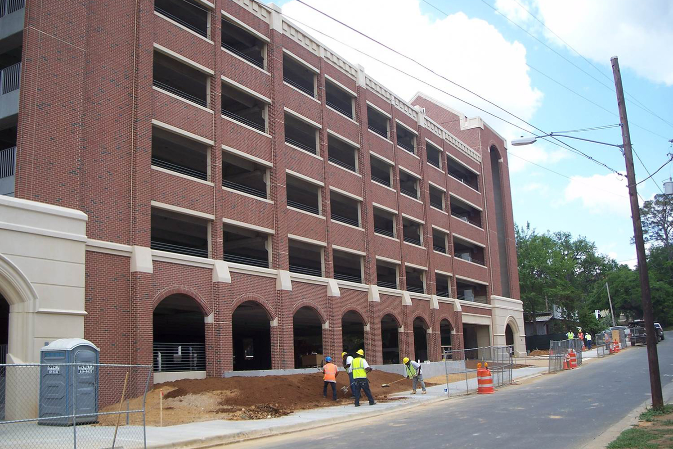
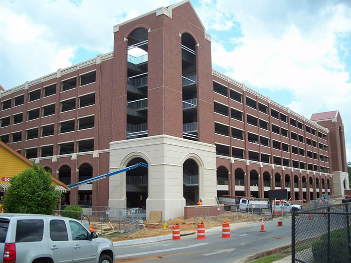
[toggle title=”Summit Erectors Inc. (for Florida St. University)”]Parking Garage, Leon County – Construction layout, control layout, As-Built drawings (2011)
[/toggle]
[accordian]
[toggle title=”Summit Erectors Inc. (for Capital Regional Medical Center expansion)”]Leon County – Control verification, Column location, Centerline layout, Column elevation, Beam tie-in location. (2012)
[/toggle]
[/accordian]